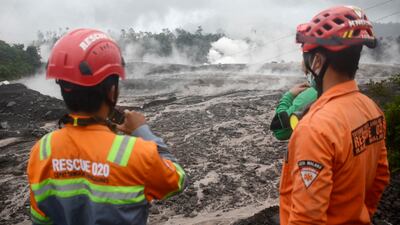
Search and evacuation efforts resumed on Monday as improved weather allowed rescuers look for possible victims, after a volcano on Indonesia’s most densely populated island erupted the previous day.
Thousands of residents in Indonesia's East Java were on high alert as authorities imposed an 8km no-go zone and forced the evacuation of entire villages.
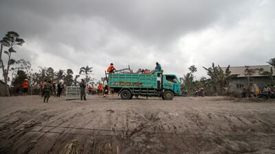
The provincial search and rescue agency deployed teams to the worst-affected areas near Mount Semeru to assess damage, with low rainfall giving some reprieve, National Search and Rescue Agency spokesman Tholib Vatelehan said.
“Yesterday, the rainfall level was high, causing all the material from the top of the mountain to come down. But today, so far, there's no rain, so it's relatively safe,” he said.
No casualties have been reported and there has not been any immediate disruption to air travel.
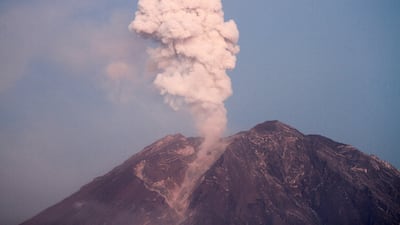
The 3,676-metre volcano erupted at 2.46pm local time on Sunday.
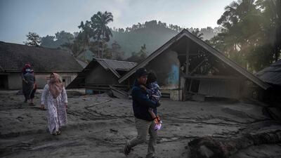
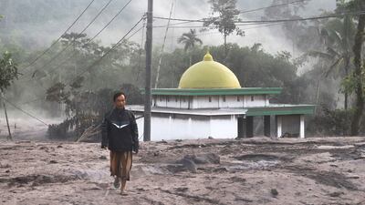
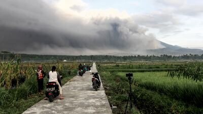
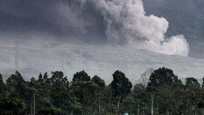
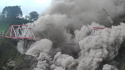
Footage shot by local residents showed Mt Semeru spewing a giant cloud of grey ash high above its crater, which later engulfed the mountain and surrounding rice paddy fields, roads and bridges and turned the sky black.
A video shared by the Environment Ministry on Twitter showed a fast-moving stream of lava, rocks and hot gases — known as a pyroclastic flow — gushing down the mountainside.
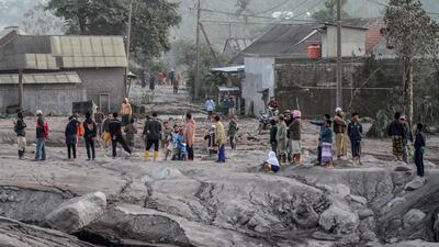
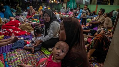
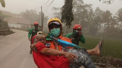
Almost 2,500 people were forced to evacuate, authorities said, with many fleeing the scene on motorcycles.
Indonesia's Centre for Volcanology and Geological Hazard Mitigation on Sunday raised the alert level for Mt Semeru to the highest level. The agency also issued a warning to residents not to approach within 8km of the summit, or within 500 metres of river banks due to risks of lava flows.
In Semeru’s last major eruption in December 2021, 51 people were killed when villages that were buried in layers of mud.
Several hundred others suffered serious burns and the eruption forced the evacuation of more than 10,000 people.
At that time, the government moved about 2,970 houses out of the danger zone — including from Sumberwuluh village.
Lumajang district chief Thoriqul Haq said villagers there who are still haunted by last year’s eruption fled when they heard the mountain start to rumble early on Sunday, so that “casualties could be avoided”.
“They have learnt an important lesson on how to avoid the danger of eruption,” he said, while inspecting a damaged bridge in Kajar Kuning hamlet.
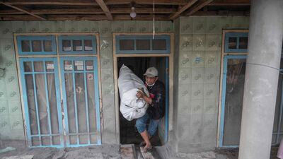
He said nearly 2,000 people escaped to emergency shelters at several schools, but many were returned to their homes on Monday to tend livestock and protect their property.
Increased volcanic activity on Sunday afternoon prompted authorities to widen the danger zone to 8km from the crater, and scientists raised the volcano’s alert level to the highest, said Hendra Gunawan, who heads the centre.
People were advised to keep off the southeastern sector along the Besuk Kobokan River, which is in the path of the lava flow.
Mt Semeru, which is also known as Mahameru, has erupted numerous times in the past 200 years. Despite the dangers, tens of thousands of people continue to live on its fertile slopes — as is the case with many of the 129 active volcanoes in Indonesia,
The eruption, some 640km east of Indonesia's capital, Jakarta, follows a series of earthquakes in the west of Java, including one last month that killed more than 300 people.
An archipelago with 270 million inhabitants that sits along the Pacific Ring of Fire — where many of the world's volcanoes and earthquakes occur — Indonesia is one of the most disaster-prone nations in on earth.
With 142 volcanoes, it has the largest population globally living in close range to a volcano, including 8.6 million people whose homes are within 10km of one.
