The UAE has moved into the fast lane of the global space race in recent years after sending its first astronaut to the International Space Station and journeying into the orbit of Mars.
A landmark moon mission is also firmly in the sights of the country's burgeoning space agency, while the UAE also recruited the Arab world's first female astronaut this year.
While space chiefs are looking to the future with huge optimism and anticipation, they are also reflecting on a milestone moment 12 years ago that provided the launchpad for their bold dreams.
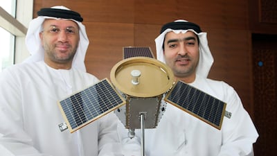
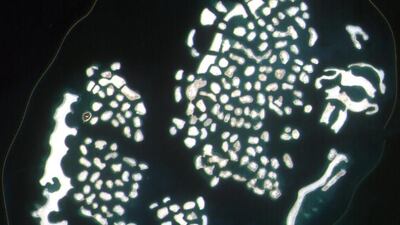
On July 29, 2009, the UAE fired its first satellite into the skies. DubaiSat-1, an Earth observation satellite that lifted off from Kazakhstan, went on to play a key role in urban developments from outer space.
It provided government bodies with pictures and data, assisting with projects carried out on Palm Jumeirah and Al Maktoum International Airport.
It also assisted with monitoring environmental patterns and weather changes.
Among the images it transmitted, the satellite, which cost US$50 million (Dh183.6m) to develop, captured imagery for the Emirates Atlas, a physical and online map of the UAE.
Such was its contribution it kept a watching brief over the Emirates and the rest of the world for six years - one year longer than planned.
The success of the UAE's maiden satellite paved the way for the remarkable progress to follow.
In 2018, engineers at the Mohammed bin Rashid Space Centre in Dubai launched their first 100 per cent Emirati-built satellite KhalifaSat.
The Hope probe successfully reached the orbit of Mars in February, as the UAE's space agency joined an elite club of five that have sent a spacecraft to the Red Planet.
In March, Dubai's environment nanosat, DMSat-1, launched into space from Baikonur Cosmodrome in Kazakhstan.
Dubai Municipality and Mohammed bin Rashid Space Centre will use the data it collects to create an air quality map of the UAE.
Built by the University of Toronto’s Space Flight Laboratory, the 15-kilogram small satellite will use three scientific instruments to gather data – a polarimeter imager and two spectrometers.
UAE's mission to Mars
It will take scientific images of the atmosphere over the UAE, helping to measure the location and levels of air pollutants and greenhouse gases. Images will be received days after launch.
Last October it was announced the UAE would build a satellite to be named in honour of Sheikh Mohamed bin Zayed, Crown Prince of Abu Dhabi and Deputy Supreme Commander of the Armed Forces.
MBZ-Sat is expected to be launched in 2023.
It will be put to civilian and commercial uses and will be built by Emirati scientists and engineers.


