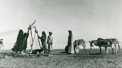
Around 60 years ago, travellers in some of the more remote areas of what is now the UAE might well have encountered a cheerful Englishman carrying a notebook with a long list of questions.
His name was Julian Walker, a junior diplomat with the title 'political agent', whose herculean task was to record the borders of the seven emirates, then known as the Trucial States.
Walker, at the time in his mid 30s, spent three winters on the project, crossing the country in a battered government Land Rover.
His report was completed in around 1960, and you can still buy a copy today as an archive edition of the Cambridge University Press.
The UAE Internal Boundaries and the Boundary with Oman runs to eight volumes and around 4,000 pages. Amazon currently has it on offer with a 15 per cent discount, at a mere Dh11, 579.
"Boundary Walker", as his colleagues sometimes called him, died two years ago at the age of 89. In 2008 he was interviewed by The National while on a visit to Abu Dhabi.
"I spent a lot of time in the desert, where it was easy to get lost," he said. "We had to map the whole place as no maps existed.
“I had to explore, get to know the territory, find out the opinions of tribesmen, then consult Sheikhs Zayed and Shakbut before the boundaries were finalised.”
For centuries past, what defined places like Abu Dhabi and Dubai were its people rather than physical, territorial boundaries.
Tribes and communities pledged their allegiance to a Ruler, bonds strengthened through marriage, and promises of support delivered when times were hard.
Sometimes these allegiances could switch, however. In 1833, several hundred members of the Bani Yas confederation decamped from Abu Dhabi as the result of a family dispute. Their leader was Sheikh Maktoum, and the rest is history.
The British, engaging in the region for the first time in the 19th century, often simply referred to the entire northern end of the Arabian peninsula as “Trucial Oman,” in reference to a series of truces they enforced between tribes.
But the nomadic lifestyle of many communities added an extra complication. A 1953 report in the Geographical Review observed that "in general, the Bedouins recognise the authority of one or another of the Trucial states but changes of allegiance are numerous.
"Bedouins may decide to make wars of their own or change sides between wars between Trucial states, which makes the political position even more complex.”
Such maps as existed were simply for navigation. As late as 1942, a British map of the region, showing how to get from Sharjah to Kalba on the east coast, consisted of a few pencil lines on an otherwise blank sheet of paper recording the likely time it would take to reach each point.
It also included compass points, and the warning - underlined - “Not to scale.”
Another report in 1948, from a member of a locust eradication team, noted that from the Gulf coast “for the distance ‘of one camel journey’ inland is Trucial territory. What happens beyond the one day’s journey nobody knows”.
It was oil that first brought an ancient, nomadic way of life into question. Great wealth lay under the Arabian sands and so land became as important as loyalty.
In the 1930’s, the Saudis, urged on by American advisers, made a failed attempt to claim that Abu Dhabi’s influence only extended a few miles inland from the Gulf Coast.
Two decades later, the border with Saudi Arabia became an issue again, this time in the villages of the Buraimi Oasis, now Al Ain, and involving both Oman and Abu Dhabi.
Sheikh Zayed, then Ruler’s Representative, played a major role in maintaining the loyalty of local tribes to Abu Dhabi against attempts to buy them off.
Julian Walker’s mission was an attempt to resolve these issues. His final report made recommendations on 20 areas of external and internal borders, with a limited agreement on seven more, and nine where no agreement could be reached.
The result was almost exactly the UAE that we know today. It marked out the seven emirates, but created no less than 22 distinct territorial areas, the result of existing tribal loyalties.
These exclaves - the territory of one state entirely enclosed by that of another, created not so much a map as a jigsaw puzzle. Sharjah has five distinct enclaves, including Nahwa, a village in the east of the country, entirely surrounded by Omani territory, which itself is bordered by further enclaves of Sharjah, Fujairah and Ras Al Khaimah.
Ajman, the smallest emirate, has two enclaves, including Masfout, which can only be reached by driving across Sharjah, Ras Al Khaimah and Oman.
Until recently, the main route into the Dubai enclave of Hatta involved a 20 minute drive along a fenced road through Oman, although this route is now closed to non-Emiratis.
The creation of the UAE in December 1971 resolved one of the remaining issues, with Sheikh Zayed and Sheikh Rashid agreeing in 1968 to implement a neutral zone on a contested stretch of land on the border between the two emirates.
Despite their complexity, the many pieces of the UAE are a demonstration of unity rather than division. The country also has external borders, with Oman and Saudi Arabia, and these, also, have had their complications.
Those interested might consider buying a copy of Arabian Boundary Disputes, published in 1992 by the Cambridge University Press.
It is 20 volumes, 18,000 words and yours for only Dh31,000 - proof that drawing a line in the sand is often more difficult than it sounds.


