Two earthquakes struck the northern Arabian Gulf on Sunday.
The first, measuring 4.7, occurred at a depth of 10km off the coast of Bushehr in Iran at 6.49am.
A second, with a magnitude of 5, struck the same area and depth at 8.25am.
There was no impact on the UAE, said Khamis Al Shamsi, director of the National Centre of Meteorology’s Seismology department.
National Centre of Meteorology
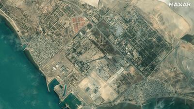
The Bushehr Nuclear Power Plant, Iran’s first commercial nuclear reactor, is located on the coast nearby.
Iran is one of the world’s most seismically active countries. Most of its earthquakes occur on land.
There are only a handful of quakes in the waters of the Arabian Gulf each year.
“You do not see too many in the sea, maybe two to five per year,” said Mr Al Shamsi.
“An earthquake of that magnitude would not cause a tsunami. These quakes are not very strong [in comparison to the one in Tonga, which was 7.4 magnitude]. They are moderate.
“Also the Arabian Gulf is shallow, compared with the Pacific and Atlantic.”
For that reason, it is unlikely there would ever be a tsunami in the Arabian Gulf, said Mr Al Shamsi.
But it did happen in the Arabian Sea in 1945, due to a strong earthquake off Pakistan with a 8.1 magnitude.
A resulting tsunami was recorded in Oman and even Seychelles, 3,400km away.
An earthquake with a 6.3 magnitude struck Bushehr province in 2013. At least 37 people were killed and 850 were injured. It was felt in many countries in the region, including the UAE.
Iran regularly suffers destructive quakes, which are occasionally felt in the UAE.
Since 1900, at least 126,000 people have died in Iran as a result of earthquakes.


