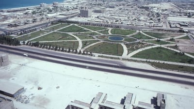
The challenge of building a 20th-century city from the desert sands is revealed here in all its audacity.
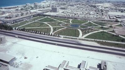
This aerial shot was taken in 1975 by Alain Saint-Hilaire, a French photographer who visited the Emirates several times in the 1960s and 1970s, capturing the growth of the nation through his camera lens. Spread out below is Khalidiya Garden, the park nearing completion as an oasis of green among the sprouting concrete of the new city.
In the foreground is a nearly deserted Al Khaleej Al Arabi Street, while the other side of the park is flanked by 16th Street. In the distance are the tower blocks at the heart of downtown, with Qasr Al Hosn, the former Ruler’s fort, just visible thanks to its coat of white paint. To the left, out at sea, is a spit of sand that will eventually form Lulu Island.
Much has changed, but not everything.
The cluster of villas on the other side of Zayed The First Street, or Electra, are still lived in by the families of employees of Abu Dhabi Company for Onshore Operations (ADCO).
In the park, the saplings have grown tall in four decades, still spreading their branches over generations of the city’s children.
* James Langton
Explore our pictorial history of old Abu Dhabi with the interactive map below, and see all of our Time Frames here.
View Time Frame in a larger map


