The UAE Space Agency is to harness satellite data to map out a trail of destruction caused by extreme weather events around the globe and develop early warning systems to limit the future impact of climate change.
The agency has joined forces with Planet Labs, a leading US-based Earth-imaging company, to compile a technology-driven Loss and Damage Atlas that will highlight the stark consequences of climate change and support efforts to mitigate its impact on vulnerable nations.
The initiative is in support of the Loss and Damage Fund, agreed at the Cop 27 environment summit in Egypt last year, which aims to compensate developing countries for damages incurred due to weather events such as flooding and droughts.
It is in line with the UAE's wider vision to accelerate the fight against climate change, as the world prepares to convene in Dubai for Cop28 from November 30 to December 12.
The Loss and Damage Atlas will be developed by UAE-based start-ups, institutes and universities, and the first demonstration of its capabilities will take place during Cop28.
The advanced technology was devised to offer assistance to developing nations hit hard by climate change, state news agency Wam reported on Friday.
It also aims to widen the availability of early warning systems for hazardous events such as extreme weather, water security issues and other climate-related events.
A cutting-edge weapon in climate fight
“Our strategic collaboration and partnership with Planet Labs represents a robust step towards building a sustainable and climate-resilient future,” said Sarah Al Amiri, Minister of State for Public Education and Advanced Technology, and chairwoman of the UAE Space Agency.
“Moreover, it reflects our commitment to strengthening our analytical capabilities to combat climate change and make better-informed decisions.
“We understand the importance of tackling global climate challenges. Thus, we will use cutting-edge technology, space data, and satellites to map the loss and damage from climate change and help establish early warning systems.
“The project also supports our plans to build capacities and adapt to the accelerating climate changes, as well as helping other countries to develop plans and strategies to limit future climate changes.”
Developers of the atlas said it would play a key role in quantifying damages inflicted by extreme weather events and further the advancement of early warning systems to limit their impact.
Under the agreement, Planet Labs will provide each participating country with access to PlanetScope satellite data.
This will allow the countries to use a near-daily country-level imagery scan with a 3m-resolution and witness gradual change happening, such as coastal erosion.
The company's SkySat Tasking capabilities will be used, which identify specific areas of interest and capture fine details – with a resolution of 50cm – of swiftly changing events, such as the immediate effects of flood damage.
Devastation of climate change
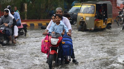
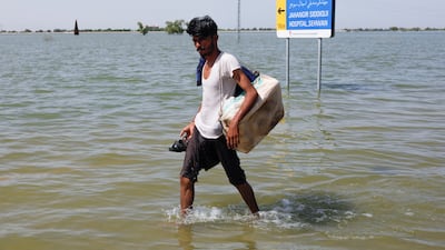
Satellite imagery revealed the devastating impact of flooding in Pakistan last summer, which left about a third of the country under water.
Heavy monsoon rains caused flash floods along the Indus and Kabul rivers that swept away homes, roads, crops and bridges.
Prime Minister Shehbaz Sharif called the flooding “the worst in the history of Pakistan” and estimated it could cost at least $10 billion to recover from the damage.
Images released by space technology company Maxar Technologies showed the levels of destruction along the banks of the Indus River, which runs almost the length of the country.
Flash floods along the banks of the river, caused by monsoon rains, devastated areas in the southern province of Sindh and the eastern province of Punjab.
The crisis in Pakistan further demonstrated the need for the world to take action on climate change and demonstrated the importance of pushing forward with a loss and damage fund to assist the worst-affected nations.


